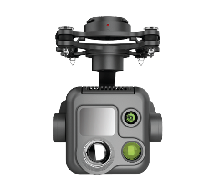
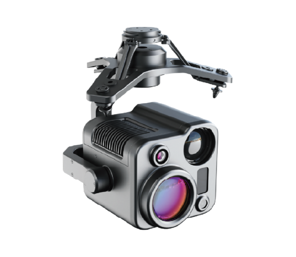
 Image 1 of 2
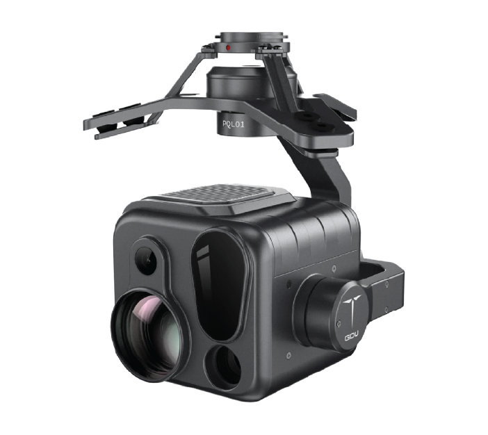
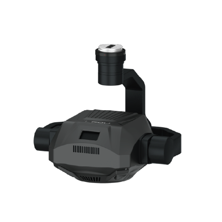
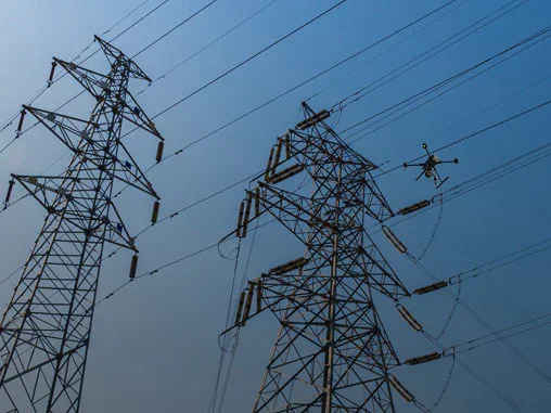
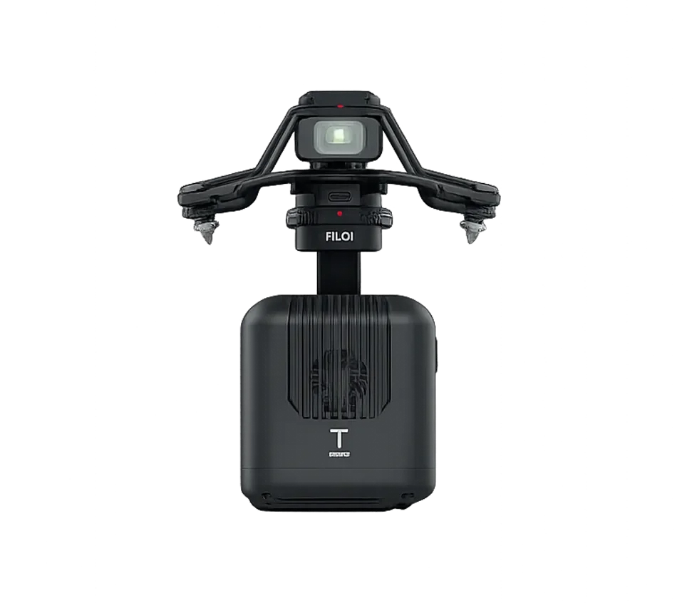 Image 2 of 2
Capabilities
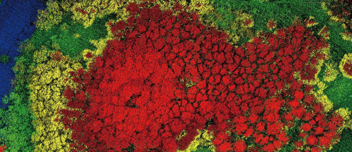
Vegetation Penetration Mapping: Fully capable of stripping away dense forest canopies and thick vegetation layers using multi-echo technologies to reveal true ground typography.
Centimeter-Level Spatial Representation: Generates ultra-precise, high-density 3D point clouds with absolute centimeter-level accuracy for strict industrial auditing.
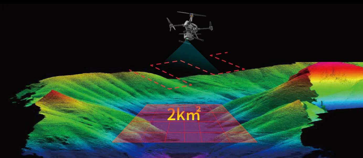
Large-Scale Structural Surveying: Capable of mapping and scanning an expansive territory of up to 2 square kilometers (494 acres) within a single operational flight.
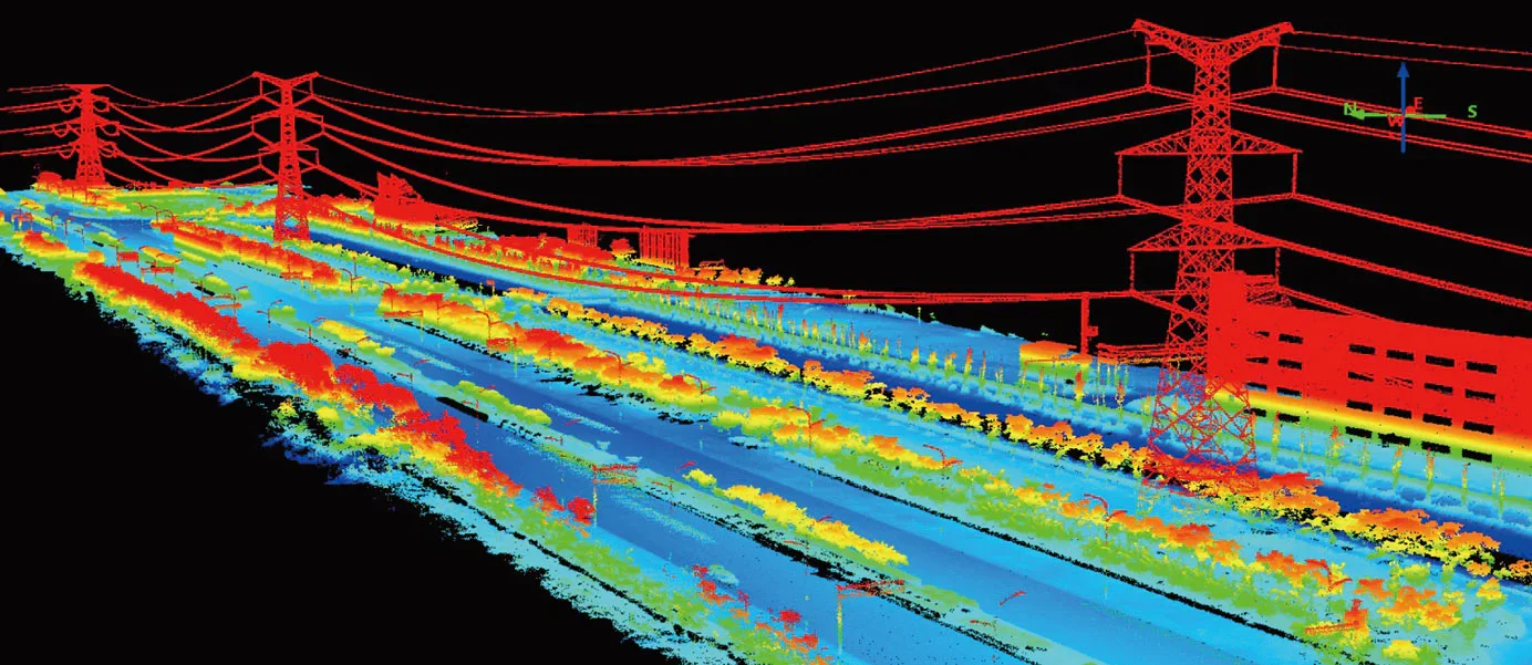
Hazard & Encroachment Identification: Actively isolates, identifies, and measures geo-structural risks, landslide vulnerabilities, and vegetation overgrowth near critical assets.
High-Rate Data Ingestion: Fully capable of acquiring, filtering, and aligning up to 720,000 geospatial measurement points per second on the move.
Technical Highlights
Triple-Echo Signal Processing: Utilizes advanced multi-echo LiDAR sensing to capture up to 720,000 points/second, maximizing ground detection under dense cover.
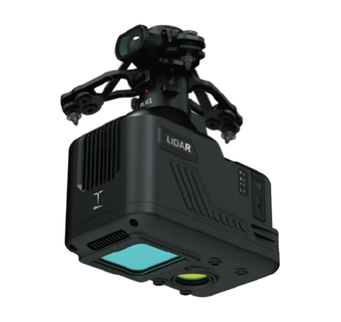
Integrated Inertial Navigation Hub: Packs a high-end GNSS module combined with a precision IMU (Inertial Measurement Unit) for continuous space orientation.
Co-Axial Mapping Camera Suite: Equipped with integrated high-resolution RGB mapping cameras to instantly colorize 3D point clouds with true-to-life visual details.
450m Long-Range Scanning: Features a powerful laser core capable of measuring precise operational distances up to 450 meters (at 80% reflectivity).
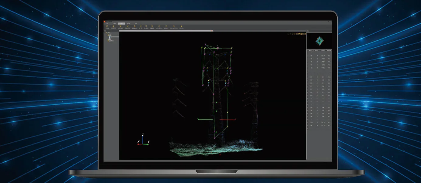
One-Click Automated Post-Processing: Supported by enterprise software for instant automatic route planning, rapid point cloud generation, and defect diagnostics.
Advantages
True Under-the-Cover Intelligence: Eliminates data gaps caused by heavy foliage, allowing surveyors to secure high-accuracy digital terrain models (DTM) where standard cameras fail.
Optimal Airframe Efficiency: Engineered with a compact, lightweight architecture tailored specifically for multi-rotor UAVs, preserving flight times and aerodynamic stability.
Risk Mitigation Engineering: Drastically cuts human exposure to hazardous areas (such as unstable mining pits or steep cliffs) by gathering flawless topographical data from a safe distance.
End-to-End Workflow Optimization: Accelerates field-to-office timelines by offering single-click software pipelines for raw data conversion and analysis.
System Specifications
Payload Architecture: Lightweight multi-sensor LiDAR system + High-resolution RGB cameras + GNSS/IMU navigation hub.
Data Acquisition Rate: Up to 720,000 points per second (Triple-echo support).
Absolute System Accuracy: Centimeter-level point cloud positioning precision.
Max Laser Range: 450 meters (At 80% target reflectivity).
Operational Flight Coverage: Up to 2 square kilometers per single deployment mission.
Applications (Sectors)
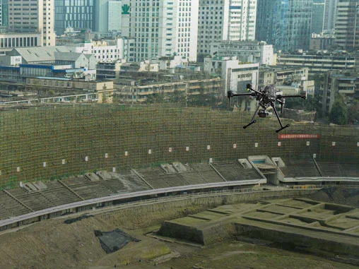

Aerial Surveying, Mapping & Land Planning: Rapid acquisition of highly accurate topographical data, digital twin city generation, and land boundary auditing.
Power Grid & Transmission Line Inspection: Tracking precise clearances, sagging cables, and evaluating vegetation encroachment threats near high-voltage corridors.
Forestry Preservation & Biomass Monitoring: Calculating precise forest density, canopy penetration audits, tree height grouping, and eco-damage management.
Geology, Disaster Relief & Landslide Risk Assessment: High-precision scanning of tectonic faults, post-earthquake asset tracking, mudslide vector analytics, and flood path building.
Open-Pit Mine Safety & Volumetric Analysis: Fast calculation of excavation volumes, structural checking of mining walls, and safety parameter auditing.