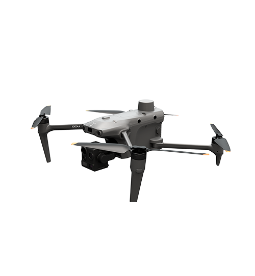
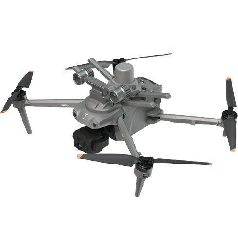
 Image 1 of 3
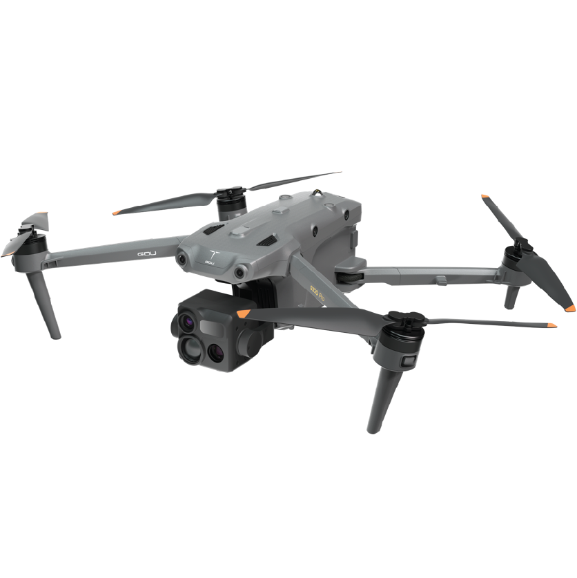
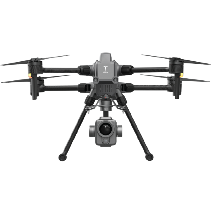
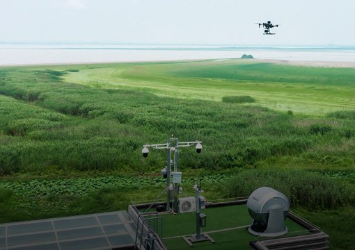
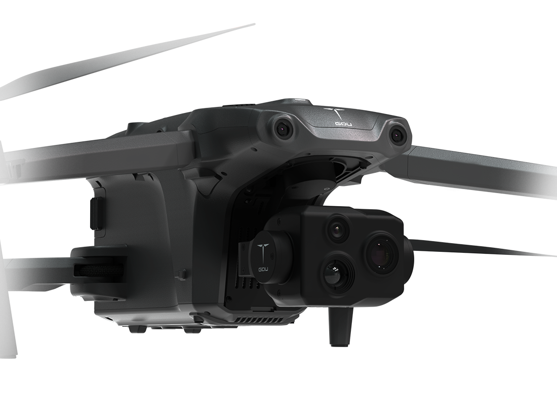 Image 2 of 3
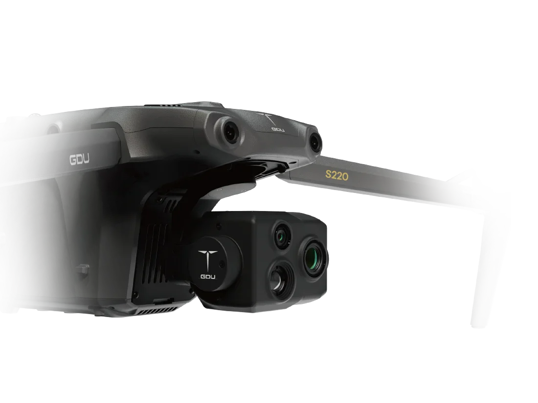
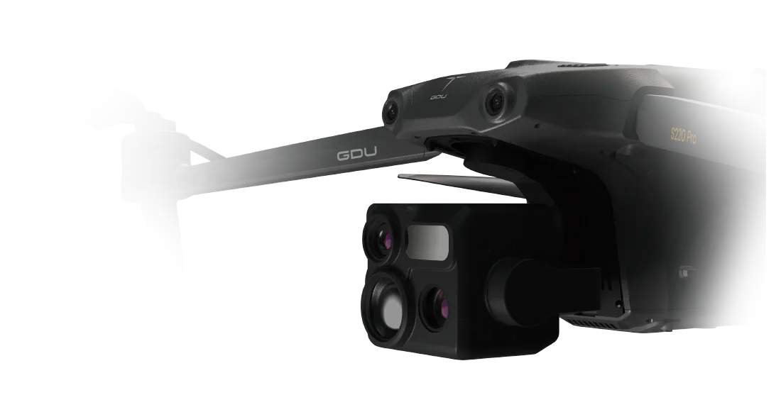
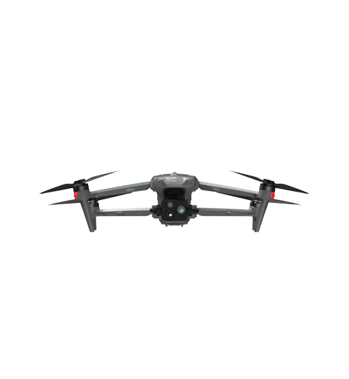
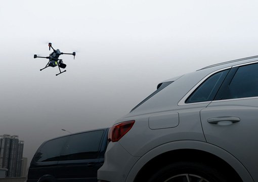
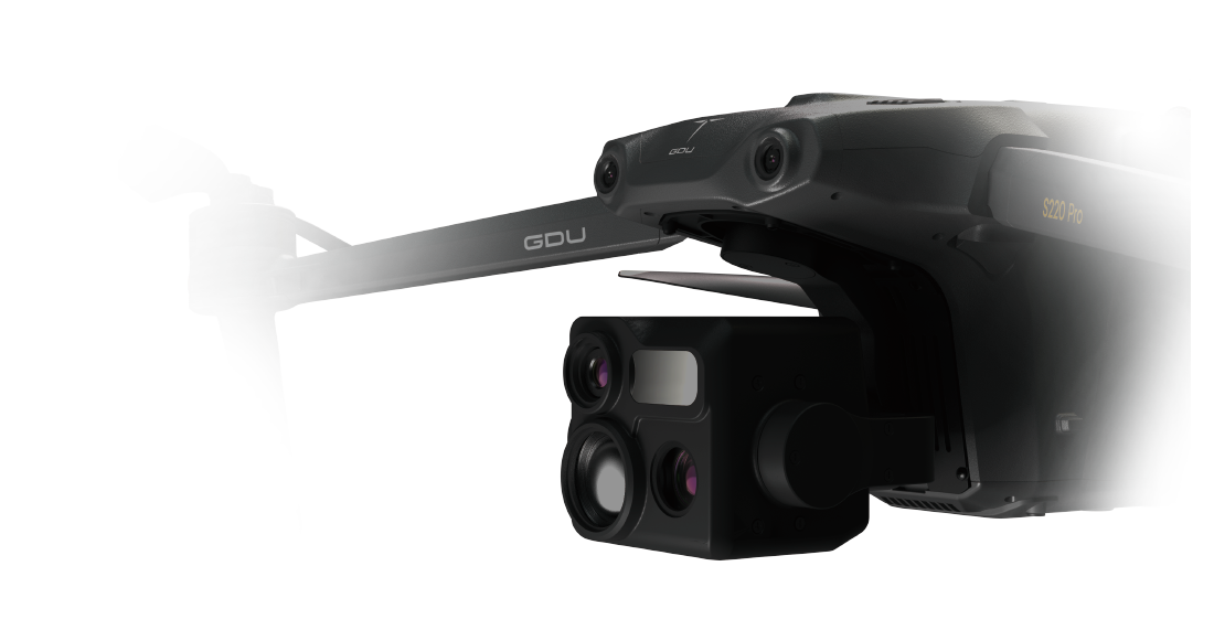 Image 3 of 3
Capabilities
Intelligent AI Obstacle Avoidance: Features 6-direction binocular vision sensors combined with AI algorithms to detect small obstacles with high precision, ensuring a safe and stable flight path.
Advanced Dual-Camera Imaging: Equipped with a 48MP wide-angle camera and a 48MP telephoto camera supporting 10x optical zoom and up to 160x hybrid zoom.
4K Full-Color Starlight Night Vision: Delivers ultra-clear 4K night imagery with an ISO sensitivity of up to 600,000, making nighttime operations as clear as day.
Visual SLAM Navigation: Utilizes advanced visual SLAM fusion algorithms to ensure safe flight and reliable Return-to-Home (RTH) even in GNSS-denied or high-interference environments.
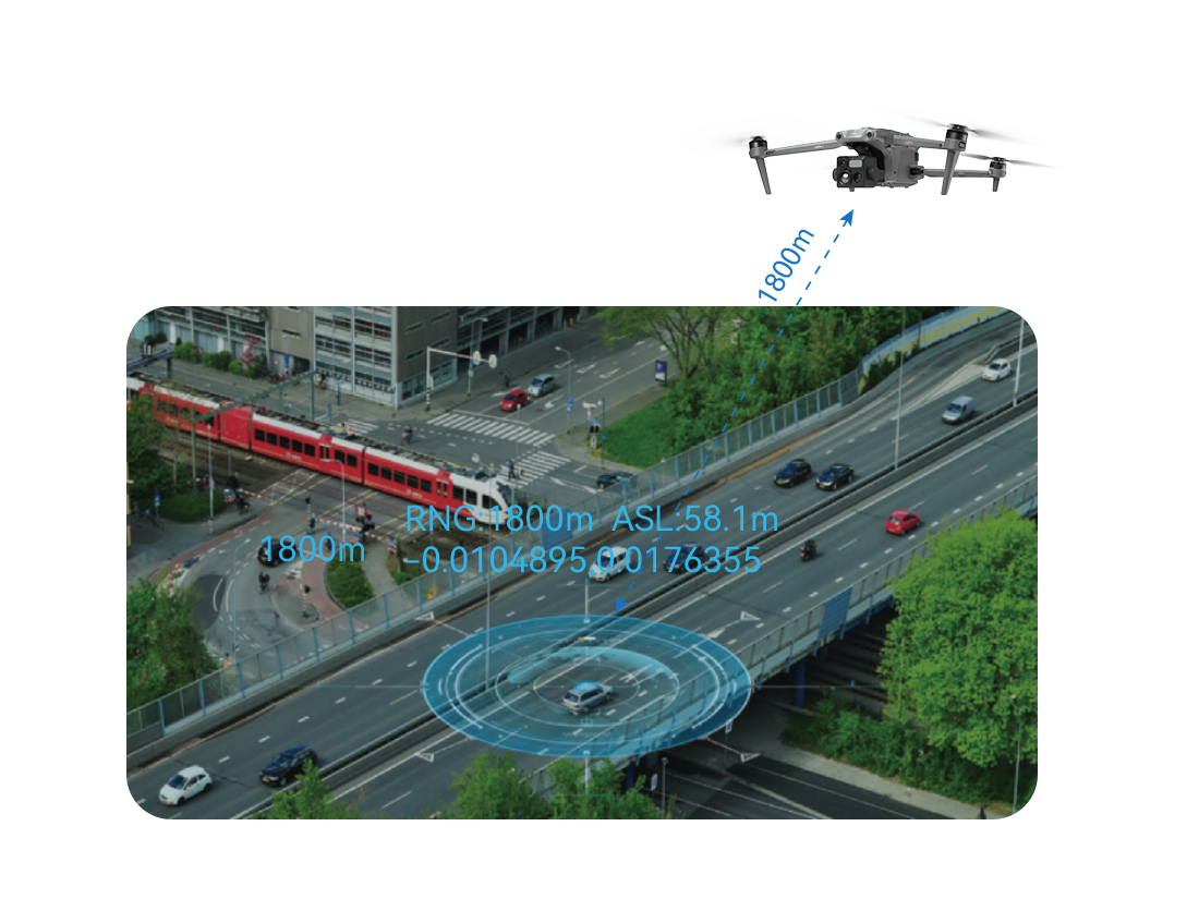
Long-Range Communication: Supports high-fidelity image and data transmission at distances of up to 15 km (FCC).
Technical Highlights
Computing Power: 21T AI computing capacity.
Sensor Suite: Includes 48MP Wide-angle, 48MP Zoom, and 640×512 thermal modules (upgradable to 1280×1024 in the Pro version).
Laser Ranging: Precision measurement from 10m to 1500m.
Flight Performance: Maximum horizontal speed of 21 m/s and wind resistance of 12 m/s.
Wide-angle imaging
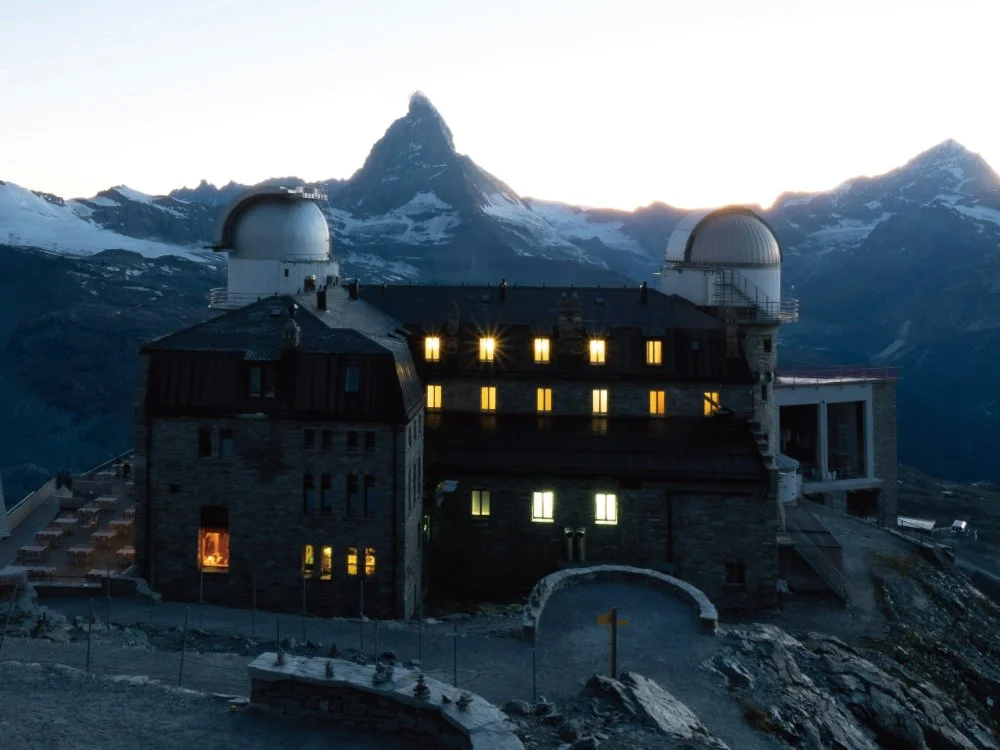
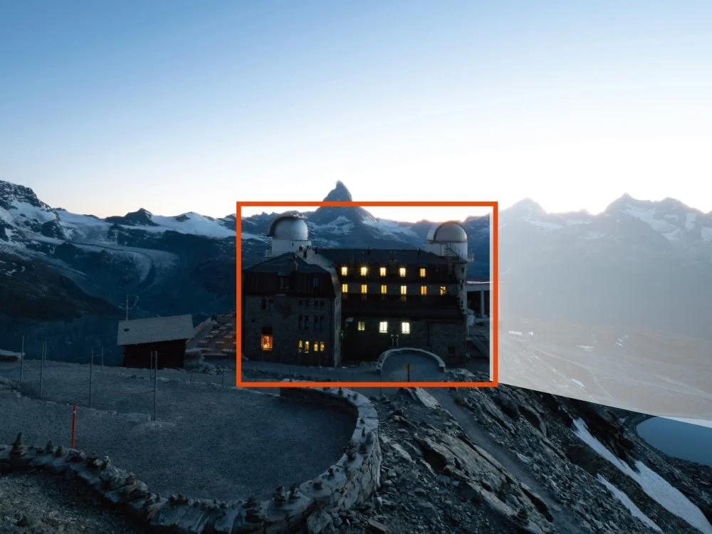
160x capture
Advantages
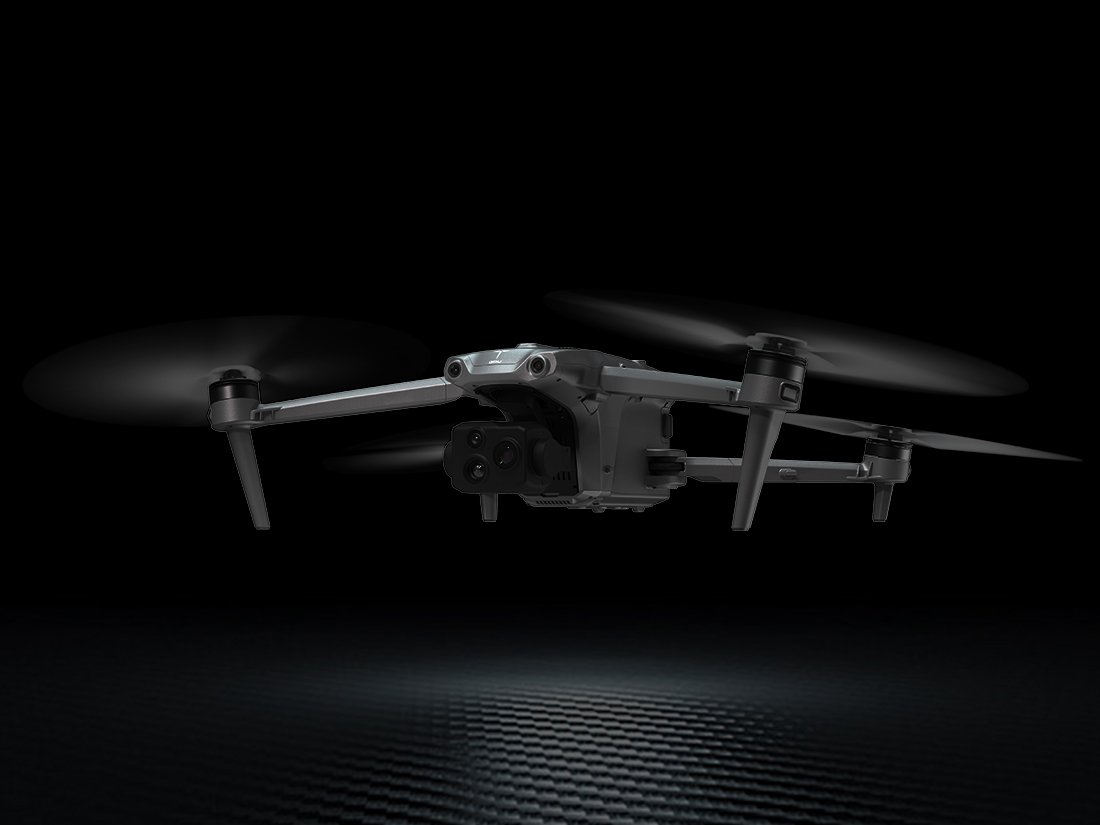
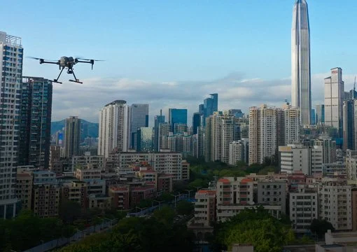
Portable & Foldable Design: A highly compact and foldable frame that allows for easy transport and storage, ideal for rapid-response missions.
Extended Mission Duration: Provides a flight time of up to 45 minutes, significantly enhancing field operational efficiency.
Centimeter-Level Precision: Integrated RTK support for high-precision positioning (1cm+1ppm horizontal accuracy).
All-Weather Reliability: Features an IP43 protection rating and is capable of operating in extreme temperatures ranging from -20°C to 50°C.
Applications (Sectors)
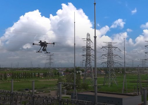
Power Grid Inspection: Automated waypoint missions and high-resolution defect detection.
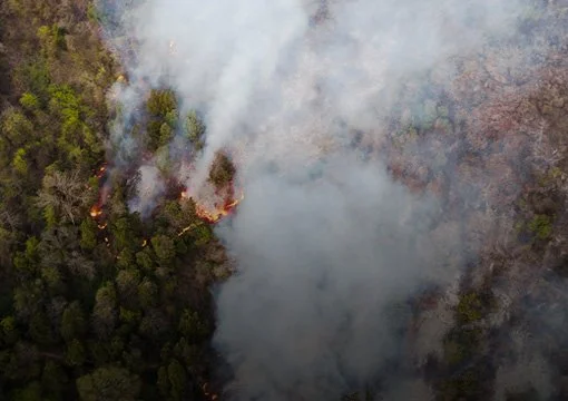
Emergency & Firefighting: Rapid situational awareness with thermal and night vision for search and rescue.
Smart City Operations: Traffic management and urban infrastructure monitoring.
Ecological Protection: Wildlife monitoring and environmental conservation.
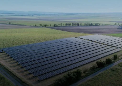
Aerial Surveying: High-precision mapping and 3D modeling for infrastructure projects.